In the Indian Ocean, there is a low-lying atoll island nation comprising approximately 1.200 islands, with 187 of them being currently inhabited. Given the limited land resources and high population densities, monitoring coastal vulnerability is a primary concern for the Maldivian Ministry of Environment, Climate Change, and Technology. One of the key responsibilities of the Maldivian government is to maintain a historical geospatial database for relevant coastal vulnerability indices.
To meet this requirement, the dedicated marine domain activity underESA Global Development Assistance (GDA), in partnership with the World Bank (WB), applied Earth Observation (EO) resources suitable for assessing the effects of climate change on different sectors related to the Blue Economy and the marine environment. This initiative aimed to empower stakeholders, policymakers, and researchers to make well-informed decisions about regional investments and endeavours, with a strong emphasis on environmental concerns. The EO products and data generated through this GDA-WB collaboration have been seamlessly integrated into the ongoing WB projects in the Maldives, including “Digital Maldives for Adaptation, Decentralization, and Diversification” and “Towards A More Sustainable And Resilient Blue Economy In The Maldives“. Their aim was to strengthen the Maldivian government’s capacity to adapt to climate change, enhance decentralised decision-making processes, and promote sustainable economic diversification, with a particular focus on enhancing coastal resilience.
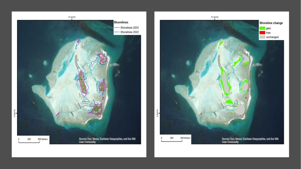
Maldives Coastal Evolution: A Close Look at Shifting Shorelines
As a cluster of coral islands in the Indian Ocean, the Maldives government recognises the paramount importance of observing and assessing its coastal areas. Shoreline monitoring is a critical practice that revolves around continuously observing and assessing coastal areas. These dynamic interfaces between land and water play a pivotal role in our environment and communities. Monitoring shorelines helps to preserve fragile ecosystems, enhance coastal resilience, ensure economic stability, prepare for disasters, manage resources sustainably, inform policy decisions, and advance scientific understanding of environmental changes. In essence, shoreline monitoring is essential for safeguarding both the natural environment and the well-being of coastal communities.
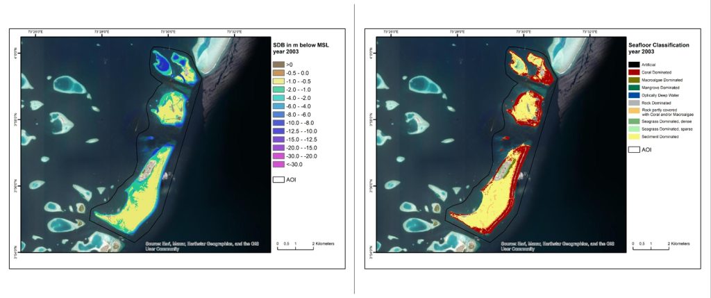
Exploring Seawater Depth and Seafloor Classification Changes in the Maldives Region
Mapping seafloor habitats is crucial in understanding and conserving the oceans worldwide. This practice notably offers scientists valuable insights into the intricate ecosystems beneath the ocean’s surface. The mapping of biodiversity in seafloor habitats helps to identify critical zones for marine life, such as spawning grounds and nurseries for various species. This knowledge is vital for sustainable fisheries management and protecting vulnerable marine ecosystems. Additionally, seafloor habitat mapping is essential for assessing the impact of human activities on the marine environment. It aids in the identification of areas vulnerable to activities like bottom trawling, mining, and pollution, thereby facilitating more informed decision-making to mitigate these threats. For these reasons, satellite-derived bathymetry was used since it is one of the most advanced EO techniques that offers a comprehensive view of underwater landscapes.
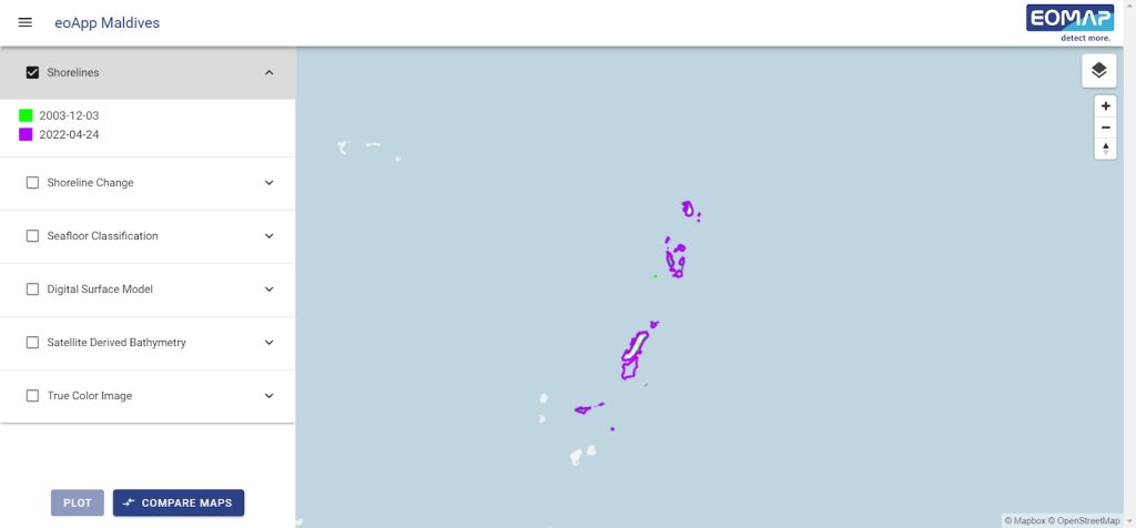
Web App Facilitates Data Access
EOMAP, as a member of a GDA consortium led by Planetek Italia, has contributed to the development of essential EO products for the Maldives region, geared towards assisting decision-making processes. These products also include a Digital Terrain Model, providing essential data for comprehending coastal vulnerability and related indices. Users can conveniently access these EO products through a web application, facilitating informed decision-making.
Key Takeaways
- Monitoring coastal vulnerability is a top priority due to the Maldives’ limited land resources and high population densities. The Maldives government maintains a geospatial database of coastal vulnerability indices. The EO products developed through this collaboration have played a crucial role in informing decision-making processes within the WB projects “Digital Maldives for Adaptation, Decentralization, and Diversification” and “Towards A More Sustainable And Resilient Blue Economy In The Maldives” projects. They supported the assessment of climate change impacts on sectors linked to the blue economy and the environment.
- To support the uptake and implementation of EO technology, the WB team and the counterparts in the country provide further capacity-building activities, including training sessions and technical assistance. These will ensure effective utilisation of the data and technology by relevant stakeholders in the Maldives.
- ESA GDA , in collaboration with WB, has launched a web application tailored to provide crucial EO products for assessing the impacts of climate change on sectors linked to the Blue Economy and the environment in the Maldives area.
- These EO products empower stakeholders, decision-makers, and scientists to make informed decisions about regional investments, focusing on environmental considerations. By providing valuable insights into coastal vulnerability and supporting informed decision-making, the data and technology have contributed to efforts aimed at climate change adaptation, sustainable resource management, and economic diversification in the region.


