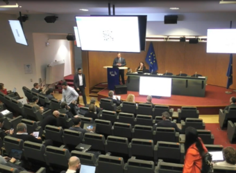
ESA recently hosted the URBIS conference at ESRIN, focusing on “Urban Insights from Space”. The event brought together experts and stakeholders to explore how Earth Observation (EO) data can enhance urban planning, sustainability, and energy management. The conference prominently featured ESA’s Global Development Assistance (GDA) programme, showcasing innovative applications of EO data in cities worldwide.
Zooming in on Solar Potential in Armenia
Elke Krätzschmar, along with Kristin Fleischer and Peter Schauer from IABG Geospatial Solutions, the prime of the GDA Clean Energy thematic activity, presented a detailed multiscale approach to solar potential analysis under the GDA Clean Energy case study in Armenia. Their presentation, titled “Zoom in – benefits of a multiscale approach for solar potential analysis”, emphasised the need for reliable and sustainable energy access in rapidly growing urban areas.In Armenia, a national-level solar potential analysis was conducted using High-Resolution (HR) Sentinel-2 imagery, surpassing the commonly used global solar atlas. With the team’s expertise, advantages and limitations of various scales were highlighted using globally distributed examples, down to engineering level. For the capital city Yerevan, the analysis using Very High-Resolution (VHR) stereo data to identify rooftops suitable for solar installations was presented, focusing on building orientation, types, sizes, and rooftop characteristics.The case study demonstrates how combining different data scales can effectively guide investment decisions, particularly for International Financial Institutions (IFIs) like the World Bank. By integrating various levels of EO data, the project helps tailor sustainable energy solutions to the specific needs of urban and rural settings, facilitating the transition towards cleaner energy sources in Armenia.
Mitigating Urban Heat Islands in Sargodha, Pakistan
Christophe Sannier, along with Christoff Fourie and Fabian Enssle from GAF AG, the prime of the GDA Urban Sustainability thematic activity, presented the Sargodha case study titled “A Remote Sensing Case Study in Urban Heat Island Information Product Development, Dissemination, and Usage for Sargodha City in Pakistan.” The study focused on mapping and analysing Urban Heat Islands (UHI) in Sargodha, a rapidly growing city facing extreme summer temperatures often exceeding 40°C.Using EO data, the team derived Surface Urban Heat Island Intensity (SUHII) to model the urban heat effect, correlating land surface temperatures with impervious surfaces. This analysis helps urban planners prioritise green infrastructure investments, such as parks and urban forests, to mitigate the heat island effect and improve urban liveability. The insights are now integral to Sargodha’s Green Transformation Action Plan (GTAP), guiding the city’s efforts to create a healthier environment for its 660,000 residents.
Pioneering Sustainable Urban Development from Space
The URBIS conference underscored the critical role of EO data in supporting sustainable urban development. From solar potential screening in Armenia to UHI analysis in Sargodha, the ESA GDA programme’s case studies highlight the transformative potential of space-based insights. As cities worldwide grapple with growing environmental pressures, these innovative approaches demonstrate how EO data can drive effective, data-driven solutions for resilient and sustainable urban futures.


