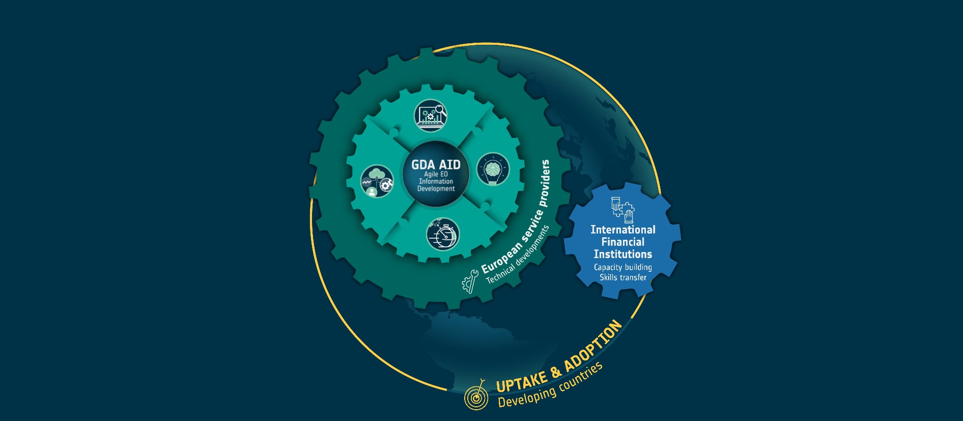
Following the recent launch of the European Space Agency’s (ESA) Global Development Assistance Transport & Infrastructure (GDA T&I), the consortium released a comprehensive brochure providing detailed insights into the various use cases it will investigate. GDA T&I will collaborate closely with the World Bank (WB) to identify and implement Earth Observation (EO) products with significant operational potential in low- and middle-income countries. The overarching goal is to enhance infrastructure resilience and sustainability. Leveraging EO products, the new GDA Agile Information Development (AID) activity aims to meet the specific needs and requirements of International Financial Institutions (IFIs) and their client states.
The GDA T&I Consortium comprises ten leading European entities in EO, Geographic Information System (GIS), and related fields.

A dual challenge: efficient and affordable access to mobility for all whilst reducing transport’s climate impact
The challenges of transport and infrastructure are multifaceted, influenced by global interconnectedness, urbanisation, population growth, technological advances, and climate change. In particular, low- and middle-income countries face difficulties in implementing safe and sustainable transport solutions to improve accessibility, and reduce road fatalities, congestion, emissions, and local pollution. As the WB puts it, “ensuring everyone has access to efficient, safe, and affordable mobility, and doing so with a much smaller climate footprint”. Addressing these challenges requires ambitious investments and initiatives to avoid unnecessary travel, shift to cleaner solutions, enhance infrastructure efficiency, and strengthen system resilience for sustainable development and economic prosperity.
GDA Transport & Infrastructure use cases
The GDA T&I Brochure explores the following seven use cases:
- Monitoring infrastructure construction: By using Machine Learning (ML) and Deep Learning (DL), EO can accurately monitor construction progress, detect road attributes, and predict potential delays, providing a comprehensive view of infrastructure development and facilitating better resource allocation and project management.
- Assessing transportation infrastructure quality: EO provides a cost-effective solution to monitoring and maintaining vast and complex transport networks. By enabling early detection of deterioration, and supporting maintenance planning, EO-informed decision-making, contributes to the resilience and quality of transport infrastructure.
- Developing inventories of existing transportation infrastructure: High-resolution satellite imagery offers a scalable and cost-efficient method for accurately creating transport network inventories. In this way, EO supports improved decision-making for maintenance, development, and policy planning, in this way improving global transport network sustainability.
- Assessing infrastructure vulnerability to climate risk: This use case centres on the challenges posed by climate change on global infrastructure, such as sea level rise and extreme weather events. EO technology, combined with weather data and climate models, enables the assessment and management of risks posed by climate change, such as sea level rise, by providing detailed analyses of potential impacts.
- Assessing mobility patterns: EO complements traditional sources of mobility data by providing insights into traffic patterns, transport modes, and barriers to mobility. This technology helps in understanding long-term trends and the broader context of infrastructure and mobility, offering a valuable tool for traffic modelling, and planning in urban and rural areas.
- Mapping road safety hazards: EO addresses the need for reliable data on road conditions and safety hazards, such as land subsidence, which can damage roads and pose safety risks. By providing up-to-date comprehensive coverage to monitor conditions and identify hazards, EO enables affordable maintenance, repair prioritisation, and long-term planning, ensuring the reliability of transport networks.
- Characterising transport infrastructure demand: EO and GIS play a pivotal role in analysing land use, settlement dynamics, and infrastructure conditions, aiding in identifying areas of high demand or poor connectivity. This data supports strategic investment and planning, ensuring transport infrastructure development is responsive and sustainable.
This blog is the second in a series designed to provide a comprehensive overview of these IFI programme engagements, the selected transport and infrastructure use cases, as well as the specific EO products generated. For additional details, please visit the GDA programme website, accessible via the GDA T&I webpage.
Please contact the GDA T&I team via GDA-TI-IABG@iabg.de should you have any questions.


![[VIDEO] Space for IDA progress review film from Imperative Space](https://gda.esa.int/wp-content/uploads/2024/06/Imperative-Space-340x250.jpg)