











The ESA Global Development Assistance (GDA) Forest Management activity is supporting the South Sudan Natural Resources & Livelihoods Project, run by the World Bank (WB). This collaboration uses satellite Earth Observation (EO) to help identify priority areas for planned community forest management (CFM), weighing factors such as biodiversity value, contribution to the forest economy and local livelihoods, and vulnerability to threats. The GDA Forest consortium, led by GAF Geospatial GmbH, will also assist CFM experts in developing prioritisation criteria and in building capacity to use EO data. The aim, as set out in the terms of reference for the work, is to provide detailed, science-based information on South Sudan’s forest cover and resources for the first time, in a country where almost no such data exists.
This story highlights the EO developments undertaken so far. The first phase delivered baseline geospatial products for a demonstration site in southern South Sudan, and the second phase refined these products and extended their coverage for cross-border evaluation of the forest ecosystem. Both phases are now complete, with a final feedback session with the WB team and national counterparts still to be held before the products feed into the WB Concept Note for a future programme.
A country with forests but little forest data
South Sudan’s forests and woodlands support the daily lives of rural communities across the country, providing timber, fuelwood, and other forest products, protecting watersheds, and sustaining wildlife of high biodiversity value. Forests cover around 30% of the country’s land area, and these ecosystems have exceptionally high integrity, still holding native species that neighbouring countries have largely lost. Much of this biodiversity is concentrated in the Imatong mountain range in the country’s south, which rises to Mount Kinyeti, at 3,187 metres, the highest point in South Sudan, and holds the Imatong Central Forest Reserve and several national parks. The Imatong Central Forest Reserve holds a range of ecosystems from natural forest and savanna woodland to grassland and wetland, with a large number of endemic and threatened species.
The country’s renewable natural resources remain largely untapped but are fundamental to rural livelihoods, and its forests are still generally well preserved, due to low pressure from agricultural expansion, though these vital ecosystems now face mounting threats. Close to a third of the country holds potential for community forest management, capable of generating over $1 billion a year from sustainable, non-timber forest products, if the information exists to plan it well.
Almost no reliable data exists for these forests: what little was collected in the past was largely lost during years of civil strife, and without a clear picture of where forests stand, their condition, and how they are changing, it is difficult to prioritise conservation, plan CFM, or direct investment where it can deliver the greatest benefit.
Using EO to map tree cover and disturbance across the Imatong range
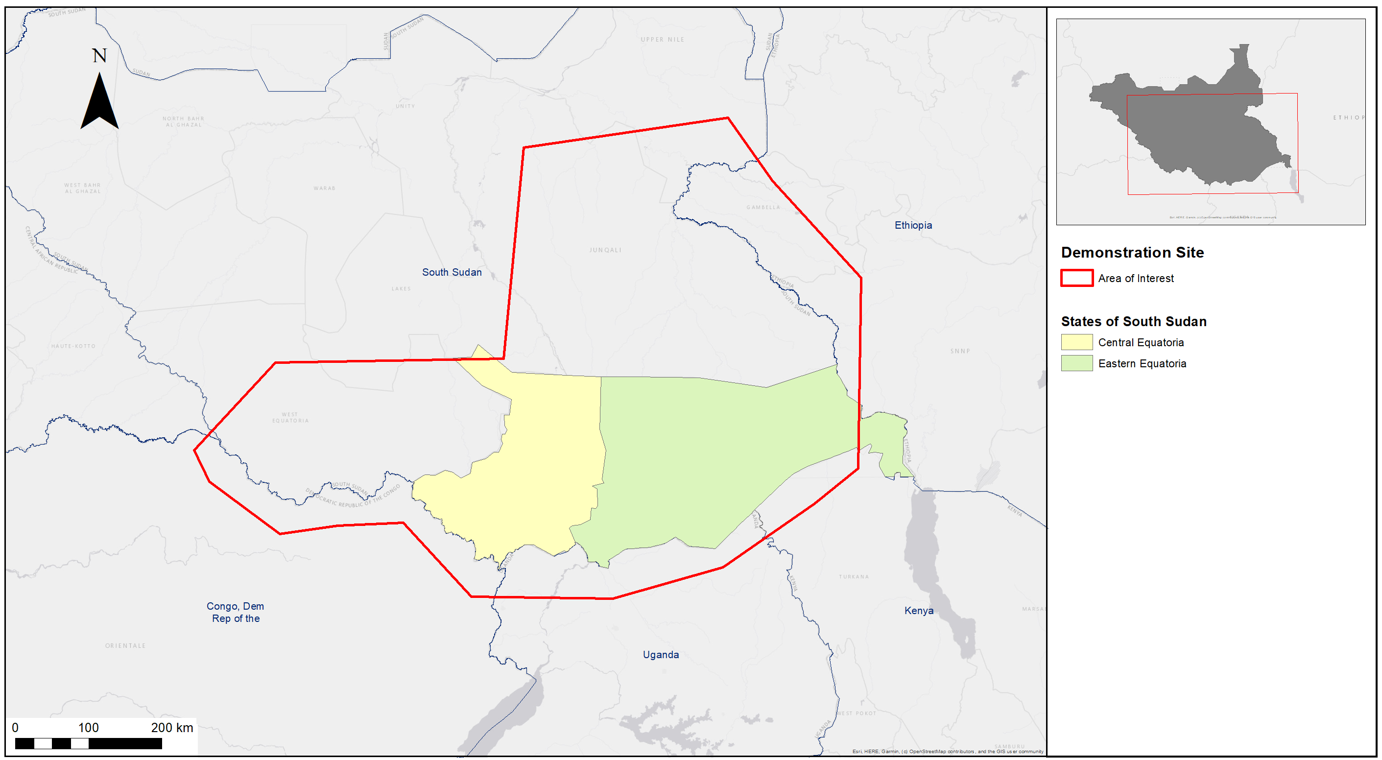
The work centres on a demonstration site of around 26,000 km² across the Imatong range, enlarged in the second phase to more than 35,000 km², with the area of interest (AoI) extending across the border into parts of neighbouring Uganda, Kenya, Ethiopia, and the Democratic Republic of the Congo.
To address the needs of the WB and national counterparts, the GDA Forest consortium, led by GAF, delivered a set of baseline EO products using freely available Copernicus Sentinel data. Together, the products answer three questions that are central to forest management: where the forests are, what condition they are in, and how they changed over time. They include:
- Tree Cover mapping (2020): The first product is a Tree Cover map, developed from Copernicus Sentinel-2 imagery for 2020 at 10 m resolution. It distinguishes tree-covered areas, whether inside or outside forests, from all other land cover, applying a 30% canopy threshold, chosen to capture the full range of humid and seasonal forests and woodlands found across the tropics. The map uses 2020, the cut-off date set by the European Union Deforestation Regulation, as a fixed point against which change can be measured. Its role is to define the tree-covered extent within which change is later assessed, so that disturbance monitoring is applied only to areas that actually hold trees.
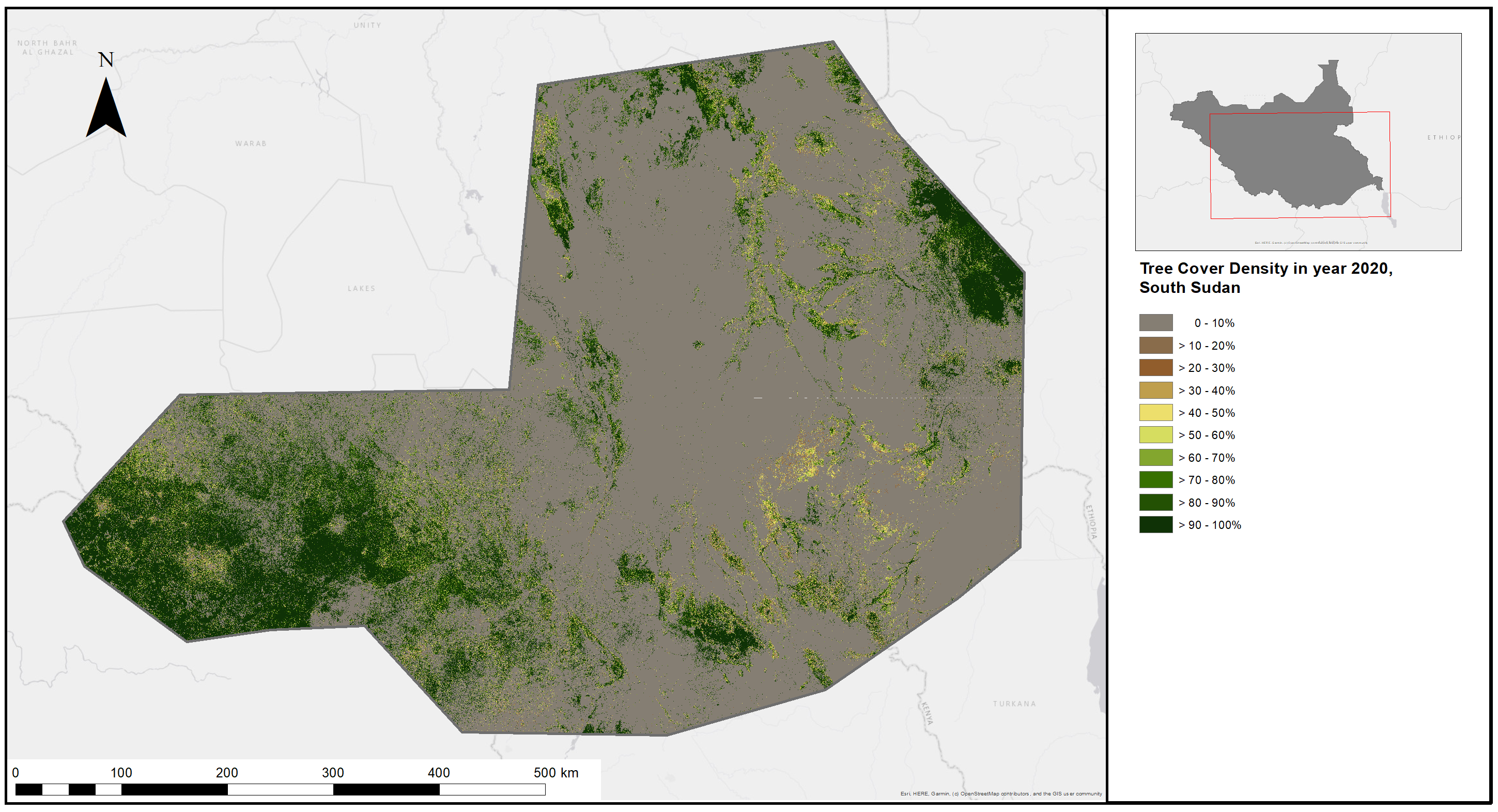
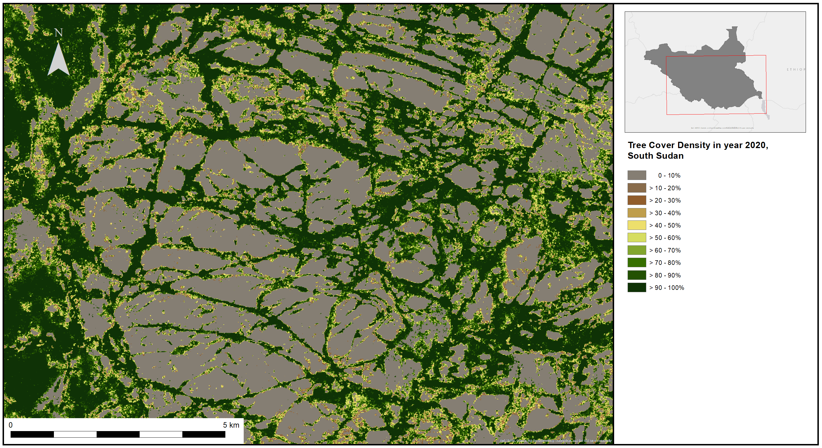
- Tree Cover Density (TCD) mapping (2020): The second product shifts from where forests are to their condition. Produced within the Copernicus Global Land Cover and Tropical Forest Mapping and Monitoring Service from Sentinel-2 imagery for the same 2020 baseline, the TCD map shows what proportion of each pixel is covered by tree crowns. This shows the structure of the forest: dense crown cover of 80 to 100% in the high mountain forests of the Lolibai Mountains and the Dongotana and Didinga Hills, giving way to the more open woodlands of the savannas and lowlands. Such gradients help distinguish intact forest from degraded or open areas, supporting forest classification and the identification of priority areas for conservation and community management.
- Tree Cover Disturbance Monitoring (TCDM) (2018 to 2024): The third product tracks how forests are changing over time. It draws on Copernicus Sentinel-1 radar, which, unlike optical satellites, sees through clouds, allowing disturbances to be captured every two weeks at 10 m resolution, across the full period regardless of weather. The spatial and temporal patterns of disturbance can support interpretation of possible causes, such as fire, logging, or clearing, though these need validation with local and national counterparts. Because it can also be applied to new observations in near real time, the product offers a practical basis for monitoring forest loss throughout the life of the WB programme.
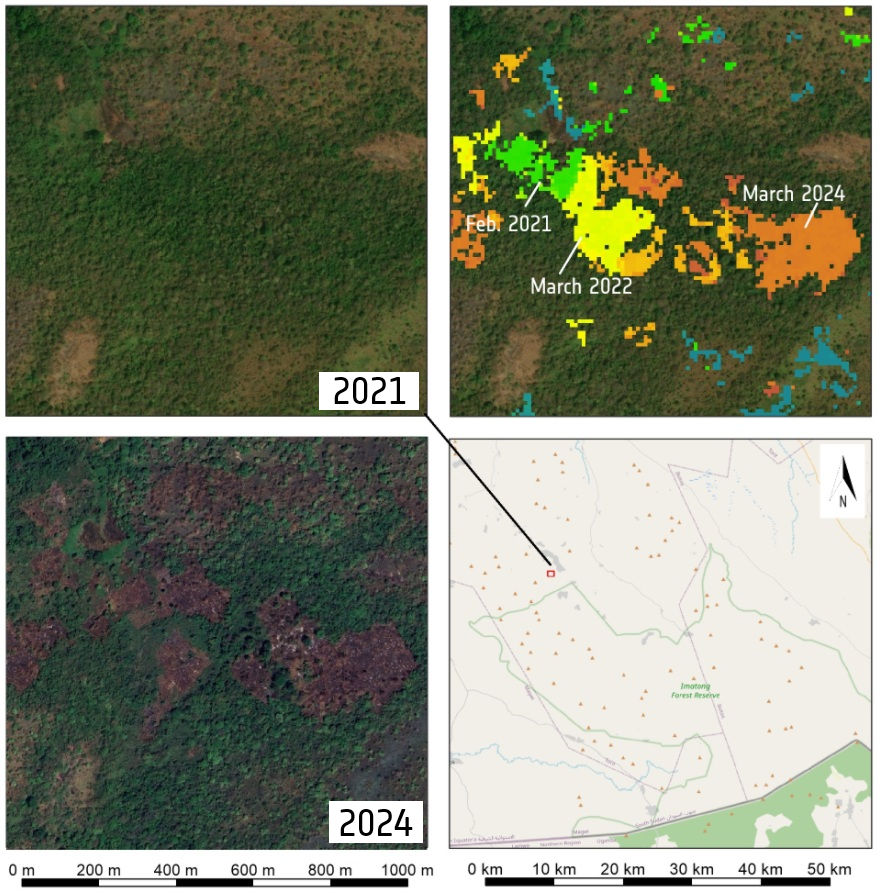
Read together, the three products give the WB task team a first view of the forest: where cover is dense and where it thins, which areas remain relatively undisturbed, and where recent loss points to fire or clearing. That helps show where forests may need protection, where reforestation could help, and where CFM stands to deliver the most for the people who depend on these landscapes, and it gives the programme a starting point for using EO in planning, monitoring and reporting.
Ensuring uptake
A key focus of the ESA GDA technical support is to build the awareness and capacity needed to put EO to work in a country where geospatial expertise is scarce and concentrated largely in universities. The consortium delivered a dedicated webinar for the WB and national counterparts on EO data, how to access it, and how to process it, and the products are being shared with the WB team to inform its programme preparation. Engaging South Sudan’s universities offers a route to reaching a wider audience and establishing these skills in the country for the long term.
With both phases complete, a final feedback session with the WB team and national counterparts will close the engagement, covering how the disturbance product should be validated and where community forest management might best be established. Although the work was focused on project preparation, the approach is designed to scale to wider areas of the country, and embedding EO into development operations from the outset leaves South Sudan better equipped to protect its forests and the livelihoods that depend on them.