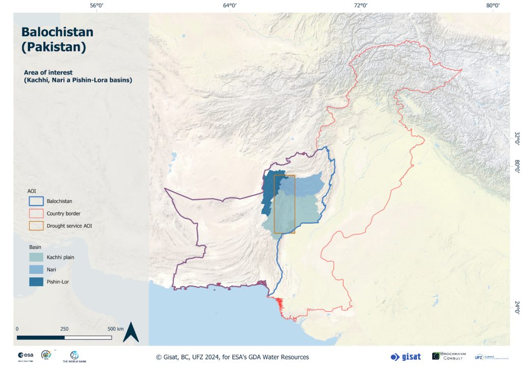
Balochistan represents a province of Pakistan located in the southwestern region of the country. It is the largest province by area, yet it is the least populated, with minimal infrastructure and challenging accessibility, characterised by an arid to hyper-arid climate with limited water availability. The precipitation in Balochistan is highly variable both spatially and temporally, leading to episodic droughts alternating with flash floods, as the last occurred in the summer of 2022 where Balochistan was the second worst impacted province of the country. Despite its desert climate, agriculture plays a significant role in Balochistan’s economy. Only a small area of the province is used as arable land, but many livestock depend on rangeland covering more than 90 % of the area. It also plays a crucial role in the food security of the province, but they are threatened both by excessive use (“overgrazing”) as well as by prolonged periods of drought.
Enhancing Water Management through EO-Based Services
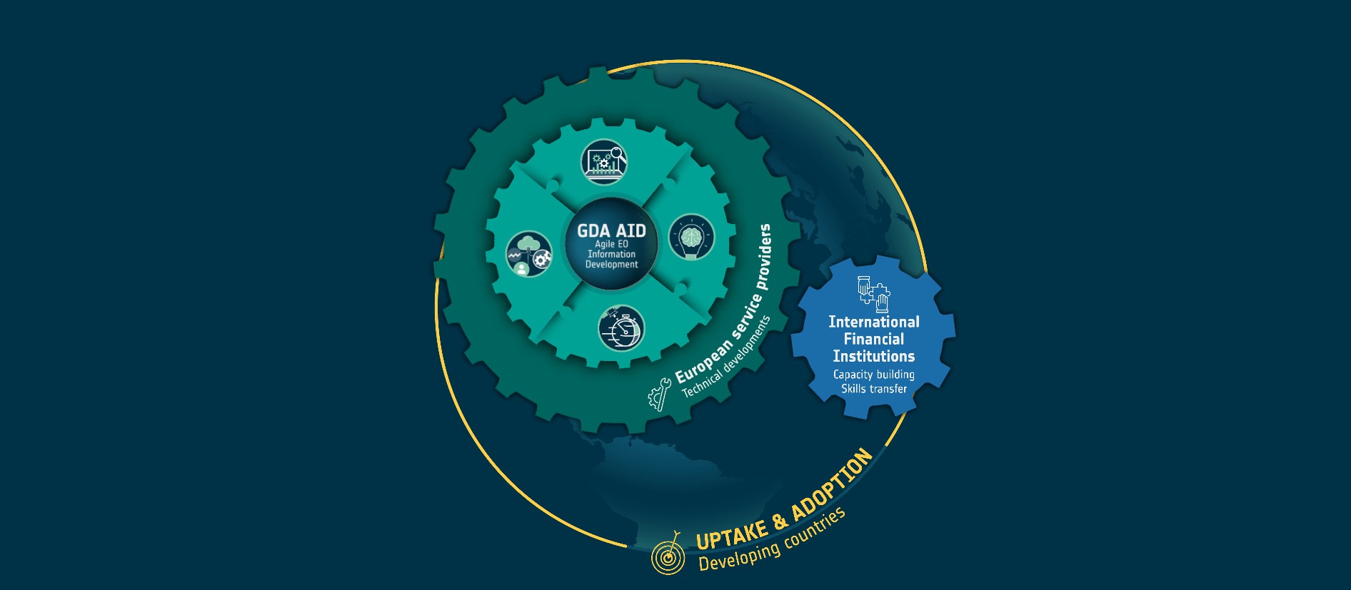
Facing water scarcity or quality issues and drought conditions, which are negatively affecting community livelihood and health, the activities of Balochistan use case within the Global Development Assistance (GDA) Water Resources activity powered by the European Space Agency (ESA) aim to trigger Earth Observation (EO) based services to enhance the ability of Balochistan’s water supply systems to withstand and recover from the impacts of both floods and droughts. Its primary goal is to make the water infrastructure more robust and resilient in the face of current challenges.
The integration of such EO data services into the Balochistan Integrated Water Resources Management and Development Project (IWRM, supported by the World Bank) represents a significant opportunity for advancement in sustainable water resource management. By leveraging satellite technology and data analytics, these services offer comprehensive and real-time insights into the region’s selected water-related dynamics and contribute to both project objectives of establishing river basin information systems and data support for improved water resource planning and management.
Implementing Advanced Hydrological and Drought Impact Services
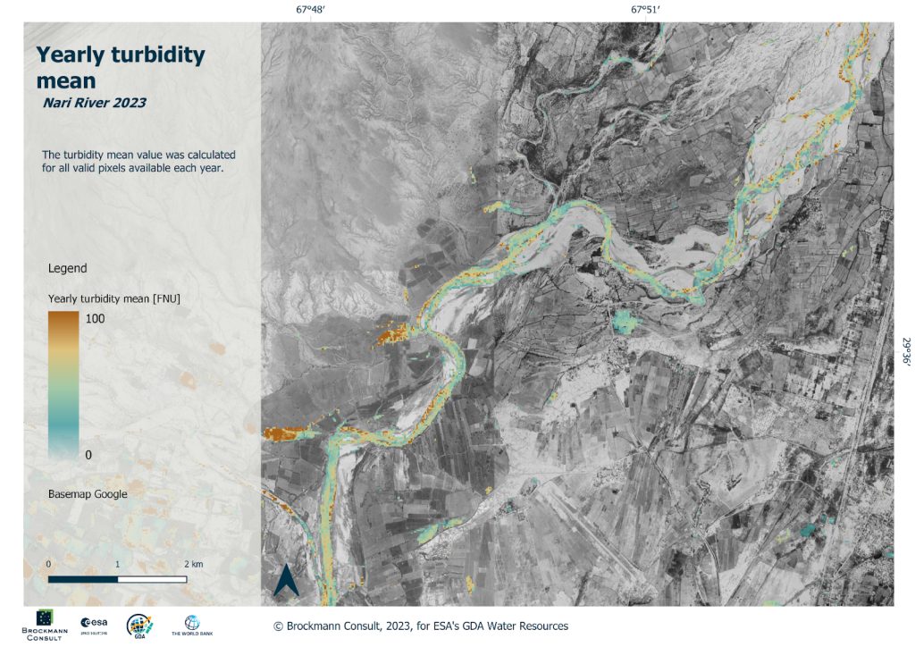
Hydrological modelling and sediment transport analysis contribute to assessing the impact on water supply infrastructure and help to improve the understanding of sediment dynamics. These analyses allow for the estimation of sediment transport rates, deposition, erosion, and other sediment-related characteristics, which are important for future infrastructure development and management strategies across entire river basins, which may be challenging to achieve using only traditional ground-based monitoring methods. Furthermore, EO provides frequent and regular observations, enabling the monitoring of sediment transport dynamics over time. Both services support the development of flood-resilient water supply infrastructure and effective water allocation and conservation strategies with a focus on the Kacchi Plain (an ancient region located in Balochistan Province).
The drought impact service focuses on rangelands, aiming to monitor drought impacts on the areas used for feeding the domestic animals. It enables a long-term comparison of drought severity, estimation of possible drought length and also spatial differentiation in observed areas. These insights help identify trends and anomalies in water usage and availability, crucial for addressing the challenges posed by climate change or overuse. Incorporating EO data can indicate crop water status focusing primarily on the detection of water deficiency which can be further used in the optimization of irrigation management enhancing the resilience of communities in Balochistan.
These services conducted by GDA implementing partners Brockmann Consult, Helmholtz Centre for Environmental Research (UFZ) and Gisat bring integrated views on the water resources and drought-related threats by:
- Identifying “hotspots” of rangeland degradation due to climatic changes together with excessive use and detection of anomalies indicating water deficiency which could be then used to support optimization of irrigation management.
- Prediction of river discharge under current and future climate projections.
- Monitoring of sediment flow and erosion patterns to protect established water infrastructures and water supply systems.
“The objective of the Balochistan Integrated Water Resources Management (IWRM) and Development Project for Pakistan is to strengthen the provincial government’s capacity for water resources monitoring and management and to improve community-based water management for targeted irrigation schemes in Balochistan. The presented GDA services provide valuable input to support these activities in water resources development by assessing key factors such as flood dispersion and influence on the infrastructure (flood protection), protection of agricultural land, water availability and identification of areas with the most significant benefit of available water for farmers.”
Zelalem Tesfaye Mekonnen, Water Resources Management Specialist, WorldBank


