The Blue Economy, which encompasses industries reliant on coastal and marine resources, plays a crucial role in the global economy, contributing over US$2.5 trillion annually. In addition to this substantial economic input, this sector is responsible for creating numerous employment opportunities and providing a wide range of supplementary advantages and services. Unleashing the Blue Economy of the Caribbean area is essential for the region’s sustainable development, economic resilience, and environmental preservation. The World Bank defines the Blue Economy as the “sustainable use of ocean resources for economic growth, improved livelihoods, and jobs while preserving the health of the ocean ecosystem.” With its rich marine resources, thriving tourism industry, and strategic location, the Caribbean is an ideal region for a responsible exploitation of its coastal and marine assets and perfectly positioned to harness the potential of the Blue Economy that can have a significant impact.
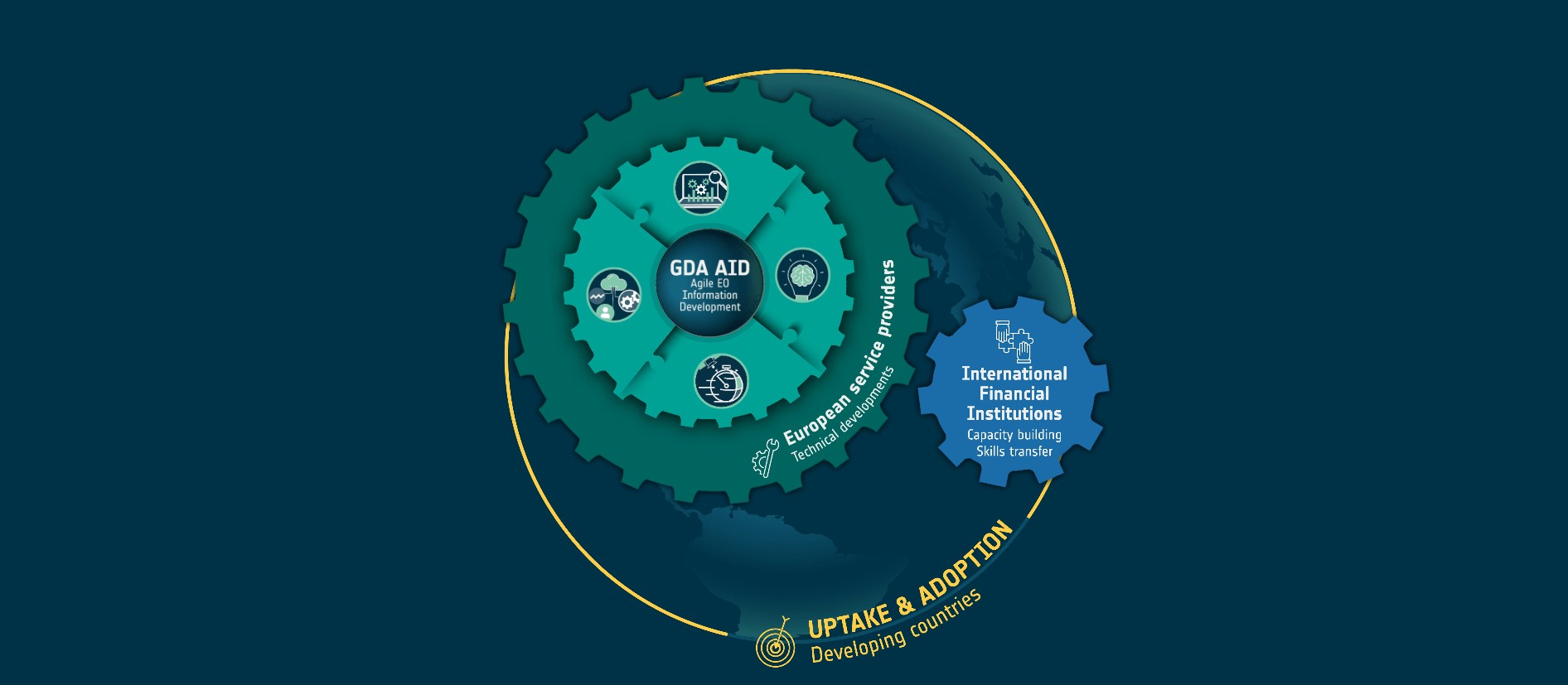
Within the framework of the Global Development Assistance (GDA) thematic area on Marine Environment and Blue Economy, World Bank (WB) and the European Space Agency (ESA) jointly initiated a series of studies aimed to compile a comprehensive environmental assessment, leveraging satellite data and remote sensing technology. It also assessed the impact of using Earth Observation (EO) products’ capabilities to implement proactive and preventive measures related to the Caribbean region’s marine environment and blue economy. These studies revealed that the primary sectors within the Blue Economy are particularly susceptible to the following water quality parameters: Chlorophyll Levels and Sea Surface Temperature. This resonates with the goals of ‘Unleashing the Blue Economy of the Caribbean (UBEC)’ project, which seeks to bolster the supportive framework for the Blue Economy, foster economic development, and enhance the resilience of key coastal assets in Grenada, Saint Lucia, and Saint Vincent. It also aims to deliver swift and efficient responses to eligible emergencies.
Water Quality Evaluation and Monitoring
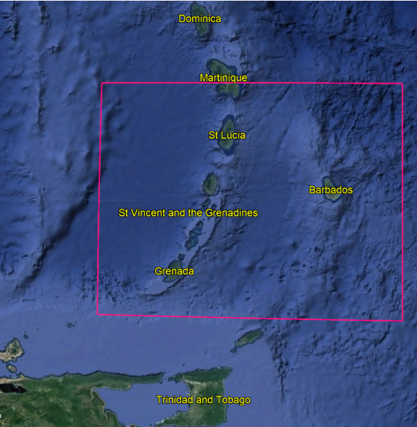
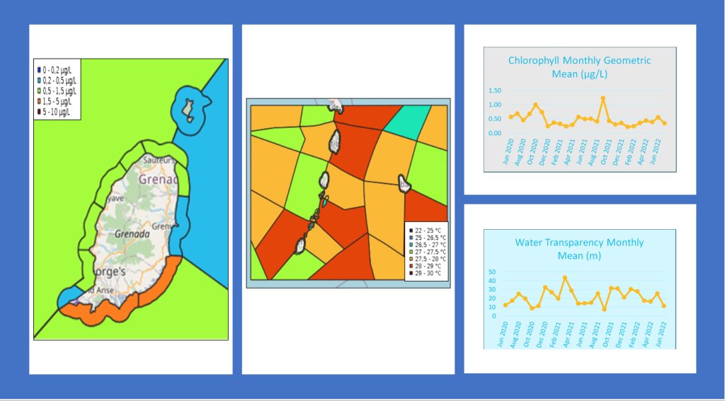
Spatial and temporal analysis of specific water quality parameters were conducted by partitioning the designated sea area (Fig.1) into homogenised subzones of varying sizes, with smaller zones encompassing the Country Islands coasts and larger ones extending into the offshore region. In each subzone, monthly statistics were derived from corresponding monthly maps, resulting in time series data that illustrate the performance of each zone for the period from June 2020 to June 2022.
The use of Copernicus Sentinel-3 satellite data and the application of analysis techniques proved to be a powerful means of providing information about water quality at large (offshore) and small (coastal areas) scales due to its high repetition frequency (1-2 days), adequate spatial resolution (300m), capacity to effectively monitor coastal areas, and sensors dedicated to the measurements of seawater characteristics.
A web application based on GeoNode, using a time slider, was employed to present the results of water quality analysis through interactive maps and monthly time series data for each sub-zone. This application provides stakeholders with a comprehensive spatial and temporal perspective, facilitating the recognition of anomalies or recurring trends from daily up to monthly and yearly scales. For instance, the time series helps differentiate regular seasonal patterns from abnormal periods. Subsequent exploration of these anomalous periods can be conducted in detail by examining the corresponding maps.
Key Contributions and Impact
- Granularity and ease of access: EO data empowers the Organisation of Eastern Caribbean States (OECS) by providing water quality assessments at high temporal (from daily to monthly) and spatial (300m) resolutions over large sea areas. The use of advanced satellite technology enhances the granularity of data, enabling a more accurate understanding of the marine environment. The access to the information was facilitated by a customised web application based on GeoNode.
- Assessing impacts: The information provided through this initiative equips stakeholders with crucial insights into the region’s water quality. Decision-makers can utilise these maps to assess the impact of human activities, climate change, or other factors on marine ecosystems. By understanding the state of water quality, OECS and related stakeholders can implement targeted interventions and policies to ensure the sustainable development of the Blue Economy in the Caribbean.
In conclusion, the collaborative efforts of WB and ESA, as showcased through the GDA AID Marine Environment and Blue Economy project, represent a significant step towards unlocking the full potential of the Blue Economy in the Caribbean. The integration of cutting-edge technology, precise data analysis, and user-friendly applications empowers stakeholders to make informed decisions and foster economic growth, while preserving the environmental integrity of this vital region.


