
EO Supporting UNOPS and ADB in Early Planning
As Indonesia scales up its renewable-energy ambitions, UNOPS and the Asian Development Bank (ADB) increasingly require consistent and objective environmental information to guide early planning and screening. Through ESA’s Global Development Assistance (GDA) programme, Earth Observation (EO) contributes to this process by updating reservoir data, identifying long-term water dynamics and providing insights relevant for the 1 GW Solar Mapping and Development Project. EO strengthens the evidence base UNOPS and ADB use in preparing and prioritising potential floating solar PV sites across Java, Madura and Bali.
The Southeast Asia Energy Transition Partnership (ETP), hosted by the United Nations Office for Project Services, supports renewable-energy development across Southeast Asia to accelerate the shift away from fossil fuels. In partnership with Indonesia’s Ministry of National Development Planning (BAPPENAS) and the Asian Development Bank (ADB), ETP promotes solar photovoltaic (PV) technology to help the country meet its renewable-energy targets and reach net-zero emissions by 2050.
Despite Indonesia’s high solar potential, land availability remains one of the biggest barriers to large-scale, ground-mounted PV. Population density, competing land uses and lengthy regulatory processes make land acquisition difficult. Using agricultural land raises food-security concerns, while developing ecologically sensitive areas risks biodiversity loss. These challenges have increased interest in floating solar PV, which can reduce land-use conflicts but also brings social and environmental implications.
In many reservoirs, local communities rely heavily on aquaculture through floating net cages. Installing floating solar plants may require removing these structures, affecting livelihoods and local food systems. This highlights the need for careful planning when considering floating solar in socially sensitive areas.
The 1 GW Solar Mapping and Development Project, implemented by ETP starting in 2019 on the Cirata reservoir, is a flagship initiative across Java, Madura and Bali (JAMALI). It aims to identify, evaluate and rank both ground-mounted and floating PV sites. This process increasingly relies on consistent and up-to-date spatial information, an area where Earth Observation (EO) can substantially contribute.
As this work progresses, national institutions and development partners, including ADB through the Solar Mapping and Development Project, increasingly rely on consistent spatial information to guide the early stages of site identification and feasibility preparation. EO contributes to this process by providing an objective, up-to-date picture of environmental conditions across potential sites.
How EO supports floating solar PV planning in Indonesia
Within the GDA Clean Energy activity, EO information is explored as a useful source of consistent information for assessing sites, ranking suitability and understanding the wider impacts of solar investments. EO provides essential geospatial context, linking environmental conditions to the criteria needed for feasibility studies. Historical and recent satellite imagery also reveal how areas of interest have evolved over time.
ESA’s GDA Clean Energy activity worked at both national and local level to highlight conditions relevant to floating solar development:
- National scale – building an initial, consistent picture of more than 80 reservoirs and larger lakes, including extent, capacity and variability.
- Local scale – providing more detailed analyses for three reservoirs corresponding to the country’s top priority sites.
This information supports the ongoing work of national institutions and development partners by helping them understand environmental constraints, identify suitable areas and prepare for subsequent feasibility assessments.
National reservoir inventory: updating extent, variability and constraints
Increasing competition for space, especially in densely populated Asian countries, shifts attention toward reservoirs as potential development areas. However, available information at national level is often limited or outdated. EO helps update and harmonise key characteristics such as reservoir extent, seasonal dynamics and indicative capacity.
For the Jamali islands, national datasets were enriched with EO-derived values for water extent, average and seasonal changes and average depth. This creates a more coherent understanding of current conditions.

Additional contextual layers supported the suitability analysis, such as:
- distribution and growth of the urban footprint (World Settlement Footprint, DLR),
- progress in electrification,
- exposure to environmental hazards (retrospective flood analysis, earthquakes),
- and other environmental indicators.
These layers collectively provide planners with a baseline for identifying promising locations and understanding broader environmental pressures.
Multi-criteria screening: geospatial suitability analysis of priority reservoirs
To deepen the understanding of environmental and operational conditions for floating PV, three reservoirs were chosen for closer investigation.

Cirata Reservoir, where a 192 MWp floating PV plant has been operating since 2023 and expansion is planned. The ETP project here acts as a reference for understanding decision criteria and impacts.
Saguling Reservoir, where a USD 60 million investment has been announced for a 92 MW floating solar project to be developed by PLN IP and ACWA Power.
Jatiluhur Reservoir, where no projects are currently planned, but its compact shape makes it a potentially relevant candidate.
Such investments affect local economies and may disrupt livelihoods, underscoring the need for sustainable decision-making. EO supports this by providing objective spatial information for both government agencies and solar developers at:
- National level – giving an overall inventory of reservoirs and their characteristics.
- Local level – offering detailed insights into site-specific conditions and changes in reservoirs and surrounding areas.
This information can be integrated into early planning steps, supporting stakeholders in preparing more informed and socially sensitive decisions.
The national picture: hazards, urban growth and energy demand dynamics

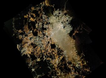
Java, the main island of Indonesia, is densely populated and undergoing rapid urban growth and infrastructure development. Energy demand is high and national decarbonisation goals depend on expanding renewable-energy and electricity infrastructure, including solar, hydropower, geothermal and wind. Smart-grid initiatives further contribute to this transformation.

Understanding environmental conditions, existing infrastructure, demand patterns and change over time is essential for sustainable planning. EO datasets, such as the World Settlement Footprint, help quantify urban expansion and identify areas where development pressure is increasing.
Within this case study, several satellite-based layers were developed to provide an updated national picture. Flood-hazard maps, derived from past flood events, land-use and land-cover information, precipitation, hydro-soil and terrain, offer insights into where risks are high. Comparing these layers with urban development patterns helps avoid unsuitable locations or identify areas where targeted mitigation may be needed.
Solar-potential maps for the Jamali islands provide further context, linking energy-resource distribution with settlement patterns. As urban growth continues and infrastructure evolves, land-intensive investments such as solar plants or wind parks must be carefully located to avoid land conflicts. This makes reservoirs an increasingly attractive option for renewable-energy development.
Water extent and depth: long-term EO insights for floating PV feasibility

Within this case study, the national list of reservoirs, providing location coordinates and indicative extent values, was updated using satellite imagery and long-term EO datasets. Historical surface-water records from 1984 to 2021 were analysed to describe the spatial and temporal dynamics of each reservoir. This allowed the project to identify changes in reservoir size, seasonal fluctuations and long-term variability. In several cases, the updated values differed substantially from previously available figures, in some instances by up to 75%. This offers stakeholders a more consistent and up-to-date basis for initial screening before entering more detailed planning procedures.
Floating photovoltaic plants require compact areas, steadily covered by water with reasonable depth. For the above-mentioned three reservoirs an analysis was derived, delineating the distinct water body and surface as well as water levels based on the occurrence of surface water during the specified period. Here, specifically shallow water of smaller extent becomes crucial
The results highlighted in red, yellow and blue in Figure 4, illustrate the variation in water level (max extent; 95%, 90% and 85% water coverage) throughout the last three decades and help define the maximum extent of the reservoir’s water surface.

Understanding depth conditions is equally important. Shallow water zones need to be avoided, while deeper parts of the reservoir require more advanced mooring systems. These systems become increasingly complex and costly as depth increases, which has direct implications for engineering design, operations and maintenance. Bathymetric visualisations derived from EO-supported analyses help identify these depth variations and highlight where additional field measurements are likely to be needed.
Before detailed site-selection and suitability assessments begin, this EO-based overview provides a homogeneous picture of more than 100 reservoirs on Java island that may be suitable candidates for floating PV development. It also helps ensure that planners and engineers focus field campaigns on the most relevant areas.
Figure 5 shows a bathymetric map, the Cirata Floating PV field as well as monitored water level variation over the last years. Such pre-selected areas and reservoir sections are a valuable first step to a geospatially targeted field campaign.
Aquafarming dynamics: understanding livelihoods and local impacts
Fish farming represents an important livelihood for communities living around many Indonesian reservoirs. Aquaculture structures, particularly floating net cages, are often densely distributed and their number and location vary over time due to changing water levels, local market conditions and regulatory measures. While the number of fish cages is typically regulated, it does not always reflect actual on-the-ground conditions. In many cases, facilities are added informally, relocated seasonally or clustered in zones that remain accessible during periods of low water.
Because floating solar installations may require the removal or relocation of fish cages, understanding their spatial distribution is essential for evaluating potential socio-economic impacts. Loss of aquaculture space directly affects household incomes and the wider food supply chain built around these reservoirs can also be disrupted. An accurate multi-year picture of these facilities therefore supports more informed and socially sensitive planning.

In this study, EO data, complemented by very high-resolution imagery from Google Earth Pro, was used to identify fish-cage locations across different years for the three focus reservoirs. By mapping the presence, density and movement of cages over time, the analysis provides insights into how aquaculture adapts to seasonal water variation and reservoir management practices. These temporal snapshots offer valuable reference points for stakeholders preparing early feasibility assessments, designing mitigation options or planning field consultations.
Conclusion: strengthening early-stage planning through EO evidence
The Jamali Islands case study illustrates how multi-scale Earth Observation can support the early stages of floating solar PV planning in Indonesia. By updating national reservoir information, identifying long-term water dynamics and providing detailed insights on depth, environmental variability and aquaculture activity, EO offers a consistent evidence base that complements existing data and helps focus more detailed assessments where they matter most.
The work demonstrates how national institutions and development partners can benefit from a clearer and more harmonised picture when preparing renewable-energy investments that intersect with complex environmental and social conditions. While EO is not a substitute for local surveys and feasibility studies, it strengthens the foundation for targeted fieldwork and more informed decision-making, contributing to a more sustainable and socially sensitive energy-transition pathway.