IFAD organised a webinar as part of their “Food4Thought Series“, dedicated to Leveraging Geographic Information Systems (GIS) in Monitoring & Evaluation (M&E), on 7 September 2022.
Clement Albergel, Climate Applications Scientist at the European Space Agency and Technical Officer of the GDA AID Climate Resilience activity, shared experience from GDA and its precursor EO4SD, specifically focusing on the benefits satellite Earth Observation can bring to impact monitoring.
The story below was posted by IFAD following this event and summarise the key outcomes of the discussions.
Reposted from IFAD Food 4 thought series (Initially published on September 20, 2022)
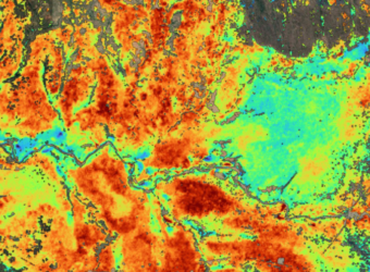
If a picture is worth 1,000 words, then a map must surely be worth far more. Maps are extraordinarily powerful ways of recording, presenting, communicating and archiving data and information. This is especially true for rural roads, farms, wells, irrigation schemes, processing facilities, marketplaces, afforestation and pasture land, just to mention a few. All these are typical subjects with spatial dimensions which can be mapped. Doing so gives project managers and donors valuable insights about projects’ activities and impacts.
On Wednesday 7th of September, IFAD organized a learning event with the participation of the IFAD team, including Dr. Jo Puri, Dr. Athur Mabiso, Oliver Mundy and Dr. Clement Albergel from the European Space Agency to discuss the use of GIS for the monitoring and evaluation of development projects.
This was the third episode of the Food4Thought series organized by IFAD’s knowledge team at SKD. The series inspires state-of-the-art thinking and provokes debates around topics that are critical for IFAD’s mandate.
Jo Puri, Associate Vice President, IFAD’s Strategy and Knowledge Department started the conversation noting that GIS and Earth observation technology offers a unique opportunity for IFAD and other development institutions to better monitor and evaluate their investments. She reinforced the need to be systematic in integrating GIS into rural development projects, while also identifying the need for technical expertise, partnerships and leadership support as key factors to promote mainstreaming of GIS.
Oliver Mundy, Environmental Analyst, explained that many IFAD-funded projects already use GIS to map their activities, but without agreed standards and only partially benefiting from the technology’s full potential. Jointly with Athur Mabiso, IFAD Senior Economist, he previously reviewed geo-tagged investment data from over 60 IFAD projects as part of the 2019 IFAD’s Innovation Challenge. Based on that experience, they were able to identify several approaches and points that would help to effectively leverage GIS in rural development projects.
For start, they emphasized that collecting geo-tagged data is the fundamental basis for using GIS and this can be done by project teams and external partners such as contractors to support project monitoring and evaluation. GIS, though, is relevant beyond that as well. The technology can also help with planning activities, field visits and resource allocation. Project managers can use dashboards and satellite imagery to see where activities are taking place (and where not), helping them to allocate resources where they are needed the most. The data also helps to adjust project intervention areas and facilitates updating of project maps. Project indicators such as length of roads rehabilitated/constructed or areas of irrigation schemes established should be measured with the help of GIS. This means that an indicator must be accompanied by a “shapefile”, a GIS data format that stores geometric locations (e.g. a line showing the road’s location) as well as attribute or metadata information of each feature (e.g. the name of the road, when it was constructed, type of road, etc.).
Collecting data for a map will not answer all questions, but it is necessary for more advanced analysis. Athur Mabiso explained that having investment sites geo-tagged is a precondition for impact assessments. Geospatial data can help select the appropriate impact assessment methods, including identifying suitable control groups and areas. Analysts can then link the geospatial data with additional information for the identified locations. For example, they can check the climatic data for the location, or detect if the household is located in a flood plain, for example.
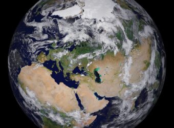
Clement Albergel, Climate Scientist at the European Space Agency, highlighted that satellite Earth Observation provides an abundance of timely and accurate information about the Earth’s atmosphere, landmasses, and oceans. When combined with societal information they can provide vital knowledge about risks, resilience and opportunities. These represent a huge opportunity for international finance institutes to better prepare, monitor and evaluate the operations they finance.
The discussion also highlighted a number of challenges. The need for more collaboration between operational and technical teams, harmonized data and metadata standards and procedures, and support of senior management. Besides, development agencies like IFAD would need to build a sufficient capacity to support its projects to collect and analyse geo-tagged data.
In his final remarks Athur Mabiso reiterated the role of partnerships but emphasized that international finance institutions like IFAD must first collect geo-data from their own investments. Once this is done, they need to work with partners that have the relevant expertise or satellite earth observation data for advanced analyses that can unlock answers to many questions relevant for enhancing project impact. The analyses can help assess risks, measure impact, monitor the status of natural resources, measure soil carbon and biodiversity, etc. The list seems endless and indeed with growing capabilities of artificial intelligence and machine learning, more relevant applications are certain to be found.