










Sri Lanka is home of one of the world’s oldest and most sophisticated irrigation systems: a network of more than 30,000 interconnected tanks, or wewa, some built over 2,500 years ago. These reservoirs capture and store monsoon rainfall to irrigate rice paddies, while simultaneously acting as buffers that protect rural communities from droughts and floods.
Today, rural communities still depend on this ancient hydraulic heritage. But extreme flooding events, siltation, and inadequate maintenance increasingly threaten the system’s performance, making modern monitoring tools essential.
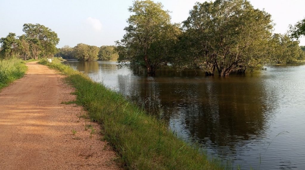
In 2025, the European Space Agency’s Global Development Assistance (GDA) Water Resources programme launched a collaboration with the International Fund for Agricultural Development (IFAD) and the IFAD‑funded Smallholder Agribusiness and Resilience Project (SARP). This partnership aimed to generate Earth Observation (EO) insights to support evidence‑based tank rehabilitation and management.
Maintaining tank cascade systems
SARP is in the process of rehabilitating 260 tanks. This includes a range of structural and environmental improvements, including reinforcing tank bunds, repairing spills and cleaning tank beds, as well as training farmers on tank operation and maintenance.
As each tank feeds into the next, changes to one tank can influence the behavior of the rest of the cascade. Efforts to restore the system that do not take these connections into account risk affecting those downstream.
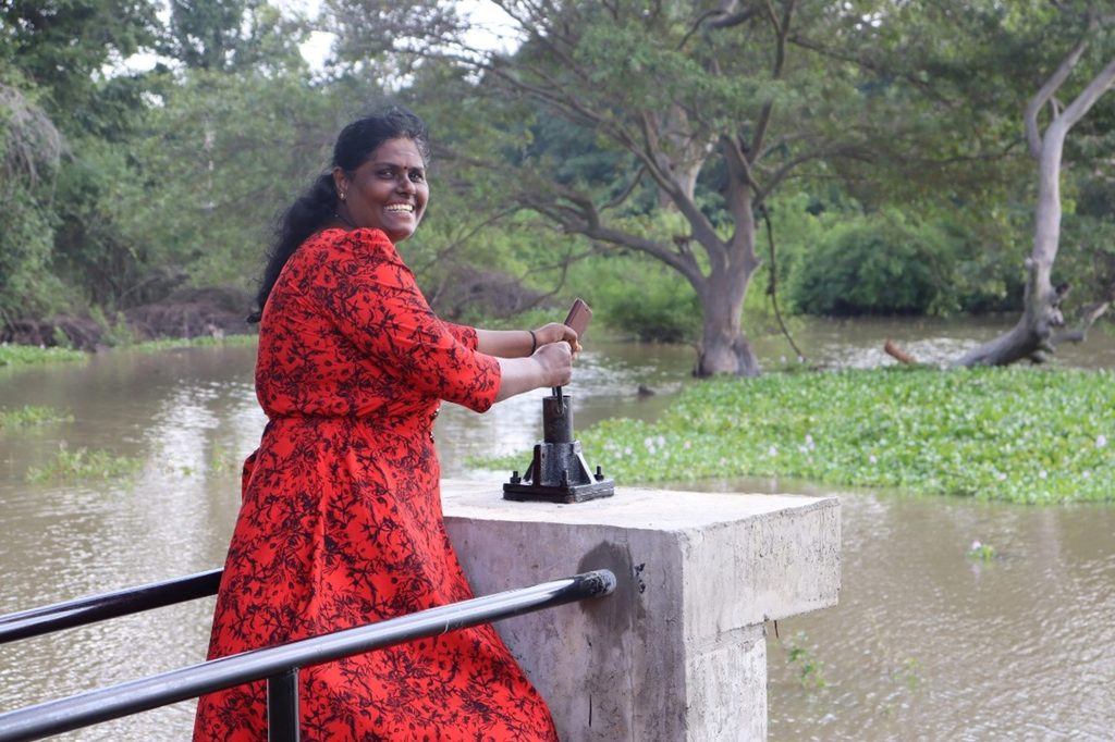
The tank cascade systems are essential to protect communities from droughts and floods. During the extreme flooding events in November 2025, tanks that were due for rehabilitation, burst and the resulting floods destroyed the paddies on which smallholder farmers depend on.
Water management authorities and farmer organizations need clear insight over thousands of tanks to see how they have been used and where storage losses are most severe.
More than 10,000 water bodies mapped
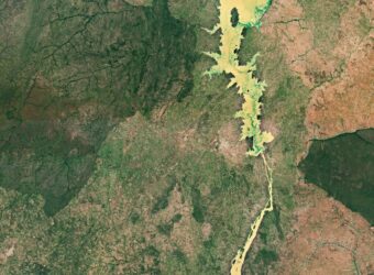
The ESA GDA water resources team aimed to support efforts of SARP and Sri Lankan water authorities by characterizing water surface dynamics using EO. They used a combination of Sentinel 1 radar and Sentinel 2 optical imagery to detect surface water on a monthly basis from January 2017 to August 2025. These observations were then merged using an algorithm to produce the final monthly products that were then used to calculate the frequency and seasonality of surface water, as well as the minimum and maximum extent of surface water per year.
The project mapped around 10,650 bodies of water at a resolution of 10 meters.
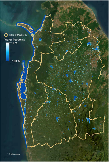
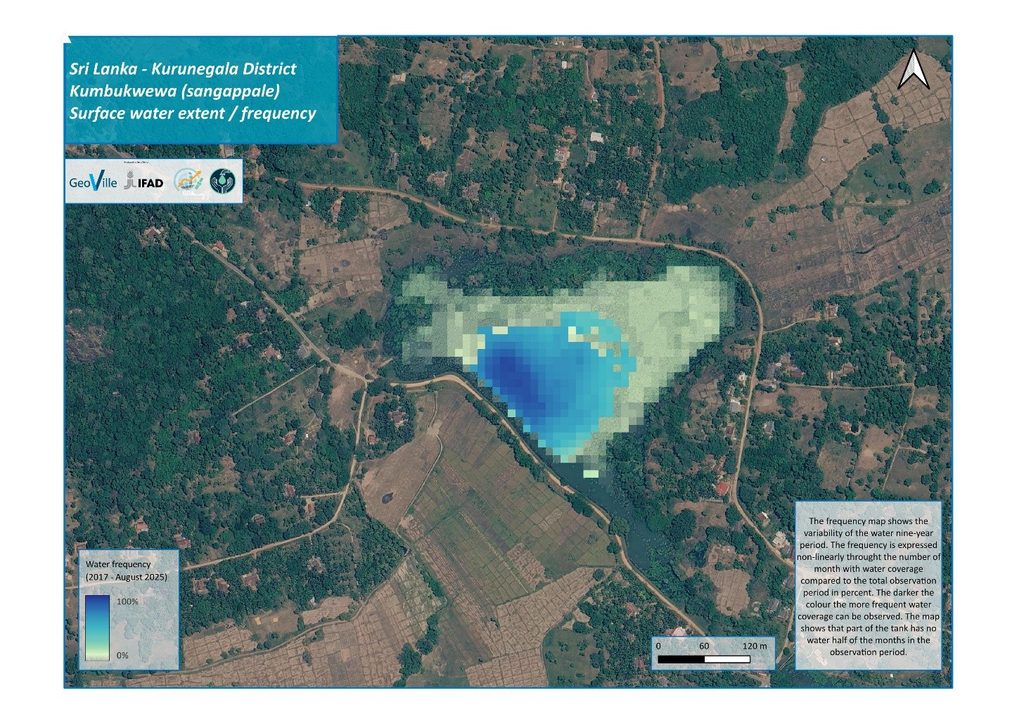
The maps show how frequently water was present in the tanks, expressed as a percentage of the months in which water was detected. This reveals both seasonal patterns and longer-term shifts in water availability.
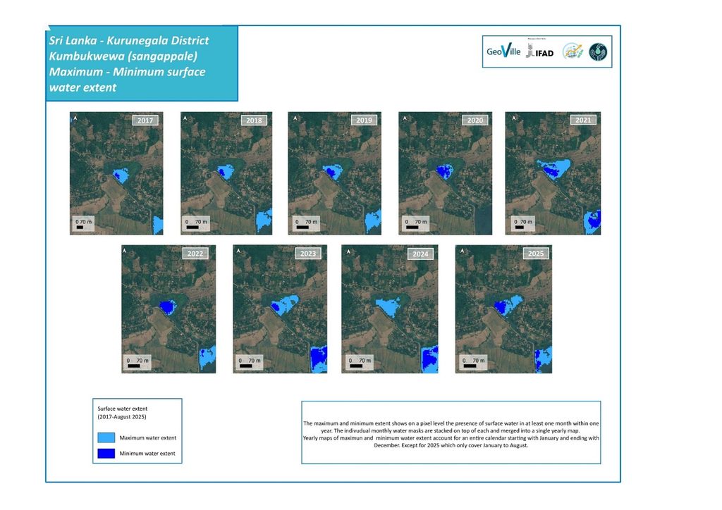
The minimum and maximum surface‑water extent makes it possible to understand changes over time. The minimum extent marks the areas that stay covered with water even through the driest months, while the maximum extent shows how far the water spreads during wetter periods, particularly during the main rainy season (locally called Maha) from September to December. Together, these patterns reveal the tank’s seasonal cycle and its permanent water zones, as well as the outer areas that only fill during the main rainy season.
Tank analysis: Understanding the story over time
The hydrological signature of 189 tanks selected by SARP for restoration was analysed in detail. The analytics include the monthly surface area in hectares, enabling managers to visualise how each tank has been used in the past nine years and how it has responded to droughts or periods of heavy rainfall. These data provide a baseline against which the impact of rehabilitation efforts can be assessed.
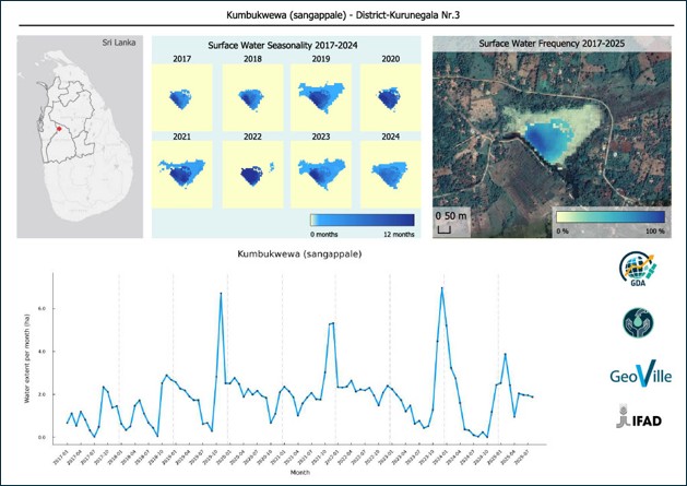
The water extent maps help us to understand how the tanks have been used over time in response to the seasonal shifts in water levels. When combined with information on paddy cultivation and rice yields, for example, they demonstrate how storage has changed, how seasonal cycles continue to influence paddy cultivation and how rehabilitation efforts impact the wider landscape. These insights provide institutions with a clearer understanding of how tank systems evolve and give communities and planners a stronger evidence base to inform their decisions. When paired with the knowledge of local farmers, satellite derived observations become part of a richer narrative about how Sri Lanka’s ancient water systems continue to support livelihoods and resilience.
The datasets can feed into various operational and spatial planning procedures for using and managing these systems. Government agencies such as the Department of Agrarian Development (DAD), the Irrigation Department and Provincial Irrigation Departments can use the information to update tank inventories, set restoration priorities and evaluate the outcomes of their interventions. Water resource planners can gain a dependable input for modelling and scenario analysis. Local farmer organisations can better interpret seasonal water behavior to support agricultural planning. Development programmes, including SARP, can identify where interventions will have the greatest impact and monitor improvements over time. In this way, the dataset becomes not only a record of past conditions but also a foundation for more informed, coordinated and forward‑looking action.
From project tool to national asset
For SARP, these maps are already changing how tank rehabilitation decisions are made. Instead of relying on a single site visit, project engineers can compare nine years of water history across every candidate tank in a cascade at once – helping confirm which tanks most urgently need repair, spot cases where restoring one tank could disrupt the flow to its neighbours, and track whether newly rehabilitated tanks, are actually holding water better than before, rather than waiting years to find out.
Beyond SARP’s lifetime, the ambition is for this monitoring capability to outlive the project itself. DAD, PID and ID already maintain Sri Lanka’s national tank inventories; layering water frequency, seasonality and extent data onto these existing registries turns static point-locations into living records, with each tank tagged by functional status and refreshed as new satellite data comes in. Handed over to these institutions, the approach can become a standing tool for tracking cascade health nationwide – helping government field staff decide where the next round of maintenance or investment is needed, long after this project concludes.
A technical note explaining the full methodology and findings is available here.
“For the smallholder families who depend on the ancient tanks, water security is the difference between a harvest and a lost season. This partnership with ESA gives SARP and Sri Lanka’s water authorities clear, evidence-based insight into how every tank in a cascade behaves over time. That means we can direct scarce rehabilitation resources to where they will protect livelihoods and build climate resilience for the long term, not just fix what is most visible today.”
Sherina Tabassum, IFAD Country Director for the Maldives and Sri Lanka
Explore more in the Impact Sphere
IFAD Technical Note and Open-Source Layer for Sri Lanka.

Julieta Maria Bolgeri
Julieta is a Project Manager at GeoVille. With a background in environmental diagnosis and management, she supports the ESA Global Development Assistance programme, contributing to water resources management as well as the ongoing FFF and APP initiatives. Her work focuses on leveraging geospatial solutions to support international financial institutions and partner organizations, including IFAD and UNOSSC, that strengthen decision-making and deliver sustainable, impactful results on the ground.

Sherina Tabassum
Sherina is a Country Director in the Asia and the Pacific Division of the International Fund for Agricultural Development (IFAD) and heads the management and operations of the Maldives and Sri Lanka portfolios. She is a policy and rural development specialist and leads IFAD’s work on the formulation of new strategies and programmes, resource mobilization, and policy engagement and partnership building with the government and development partners.