

The GDA AID Urban Sustainability activity has been supporting the project “Updating the Revised Strategic Transport Plan for Dhaka, Bangladesh”. This project, led by the Asian Development Bank (ADB), has benefited from the expertise of the GDA AID Urban Sustainability consortium as Earth observation can help with transport modelling.
Tackling Dhaka’s Mobility Challenge: The Crucial Role of Strategic Transport Planning
Dhaka has been dubbed the “traffic capital of the world”, and for good reason. With average traffic speeds having dropped to single digits, the economic loss to Bangladesh from the capital’s “total traffic chaos” is estimated to amount to between 6 and 10 percent of national GDP.
One major hurdle in addressing these challenges is to bring a wide range of stakeholders to the table and find consensus among a dizzying array of projects and initiatives. This is why the Dhaka Transport Coordination Authority (DTCA) was established in 2012 and has been making strides towards improving urban mobility in Dhaka ever since.
Another important step towards this was the approval in 2016 of the Revised Strategic Transport Plan (RSTP) for Dhaka as the authorised transport master plan for the city with a planning horizon of 20 years. Six years in, as the mobility landscape continues to evolve, new opportunities for improvement have emerged. While the journey has not been without its challenges, valuable lessons have been learned, including:
- Updating survey data regularly to ensure relevance and accuracy,
- Encouraging innovative projects from various agencies, complementing the RSTP’s priority list,
- Placing greater enphasis on multimodal integration for enhanced efficiency and accessibility,
- Strengthening connectivity between intracity and intercity public transport services.
The ambitious ADB project Updating the Revised Strategic Transport Plan for Dhaka, launched in 2022, aims to support the Government of Bangladesh to do just that.
Speeding up traffic modelling with Earth Observation
But how do you formulate an evidence-based plan for a system as complex and seemingly unpredictable as a sprawling transport network serving 24 million people? How would new transport infrastructure, say, a metro line, change citizens’ mode choices? And how would these decisions in turn affect existing infrastructure?
Part of the answer is…a model.
Transport models come in a variety of shapes and sizes, they operate at varying spatial scales and place different demands on the input data they require. Broadly speaking, one can differentiate between three types, with the latter two oftentimes depending on outputs from their respective predecessor:
- Macroscopic models, incorporating economic, socio-demographic and Earth Observation data, operate at the scale of user-defined Traffic Analysis Zones,
- Mesoscopic model extensions, incorporating Origin-Destination matrices from step 1, household survey data and traffic statistics, operate at a city-wide scale,
- localized incident scenarios, modelling, for instance, the impact of flood events on road closures and traffic, with the help of microscopic model extensions.
Where EO can help: Assessing trip generation and distribution
You might be wondering: what does Earth Observation have to do with transport modelling?
Let us take macroscopic models as an example. Put simply, in the absence of other existing datasets, an EO-derived Land Use/Land Cover map helps the transport planner determine where trips are generated and where they might be going. Here, what is key is knowing the exact location of residential and commercial land uses associated with urban land cover types. As most land uses cannot themselves be deduced from space, this information is often corroborated through non-EO reference data.
But how many trips are being generated, exactly? For this calculation, not only employment and car ownership rates are important, but also the precise location of populations by age group, as well as the employment, educational and leisure potential of non-residential areas. In data poor environments, quality controlled Earth Observation products, in combination with crowd-sourced datasets such as OpenStreetMap, can help transport planners answer many of these questions.
In addition, population counts, usually coarsely aggregated into census districts, can be proportionally re-distributed into much finer spatial units of, e.g.10x10m pixels based, among other things, on land cover types and building heights derived from EO. This data could in turn be re-aggregated into more numerous Traffic Analysis Zones smaller than the original census districts, thus increasing the spatial fidelity of the model.
The macroscopic transport model for Dhaka has been produced in Phase 1 of GDA Urban by the Austrian Institute of Technology (AIT), with a detailed Land Use/Land Cover dataset by GISAT, serving as input data alongside a 10m population density layer produced by the German Aerospace Center (DLR) (see Figure 1 below).
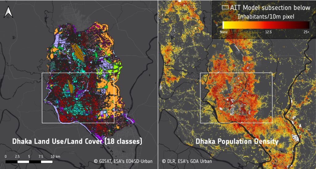
Based on these and other inputs, the AIT model provides a first quick overview of transportation demand for the 161 Traffic Analysis Zones in the 1,865 km² RSTP study area of Dhaka.
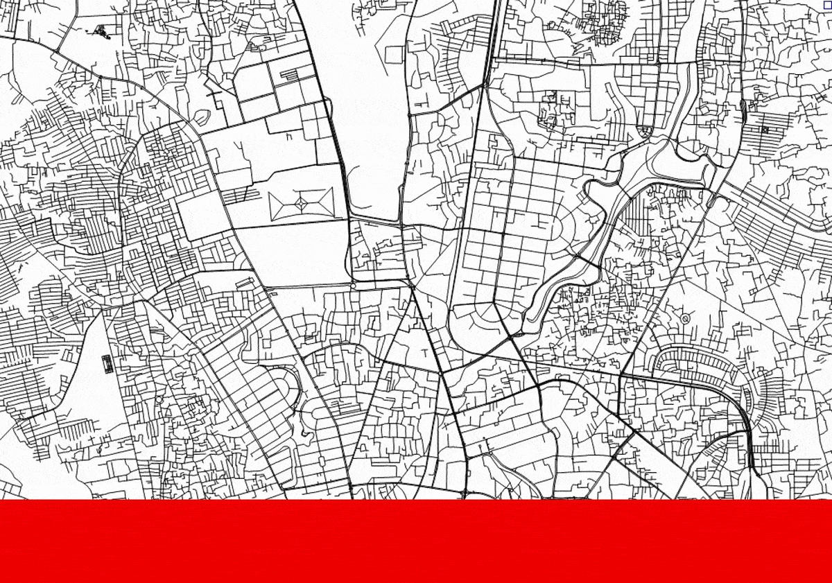
The animation in Figure 2 below gives a snapshot of the situation in downtown Dhaka, showcasing the increasing stress placed on existing pieces of road infrastructure by different transport modes.
The advantage here lies in the fact that even without a comprehensive and recent survey (which will be conducted as a part of the ADB project in 2023), it was possible to lay the foundation for demand modelling and impact assessments of existing bottlenecks. And the bonus? The modelled trip lengths per demand stratum match up with existing survey data for Dhaka.
Through the use of EO and non-EO data, this approach can be replicated in any city in the world, at scale. As a result, compared to traditional approaches to transport modelling, the EO-informed methodology to transport modelling developed by AIT can be flexibly and quickly adapted to a wide range of assumptions, allowing policy-makers and planners to iteratively compare the various impacts of possible interventions affecting trip distribution, mode choice and route assignment.
Just like you may choose a different way to get to work on any given day due to the weather, your mood, or a road closure, how we plan for a more sustainable urban mobility future needs to adapt as well. We cannot predict the future, but we can prepare for it by embracing new technologies and strategies that help us stay one step ahead of changing circumstances. Satellite Earth Observation is one such tool that offers immense potential to transform our approach to urban mobility planning. By leveraging the data and insights provided by satellites, we can make more informed decisions about everything from traffic management to infrastructure development. Ultimately, this can help us create more resilient and sustainable communities that are better equipped to navigate the challenges of the future.


![[VIDEO] GDA M&E Webinar ‘Leveraging Development Finance – ADB’](https://gda.esa.int/wp-content/uploads/2023/06/banner-webinar2card-340x250.jpg)